
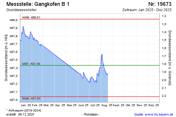
Current data Gangkofen B 1
Groundwater level [m above sealevel]: 437,13
Distance to surface [m]: 2,12
Last value from 15.06.2026 08:44
Ground level [m above sealevel]: 439.25
| Date | Groundwater level [m above sealevel] |
|---|---|
| 15.06.2026 | 437.12 |
| 14.06.2026 | 437.13 |
| 13.06.2026 | 437.15 |
| 12.06.2026 | 437.14 |
| 11.06.2026 | 437.14 |
| 10.06.2026 | 437.11 |
| 09.06.2026 | 437.08 |
| 08.06.2026 | 437.08 |