
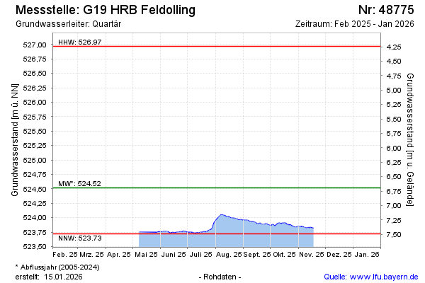
Current data G19 HRB Feldolling
Groundwater level [m above sealevel]: 523.86
Distance to surface [m]: 7.35
Last value from 23.06.2026 09:59
Ground level [m above sealevel]: 531.21
| Date | Groundwater level [m above sealevel] |
|---|---|
| 23.06.2026 | 523.85 |
| 22.06.2026 | 523.85 |
| 21.06.2026 | 523.86 |
| 20.06.2026 | 523.86 |
| 19.06.2026 | 523.86 |
| 18.06.2026 | 523.86 |
| 17.06.2026 | 523.87 |
| 16.06.2026 | 523.86 |