
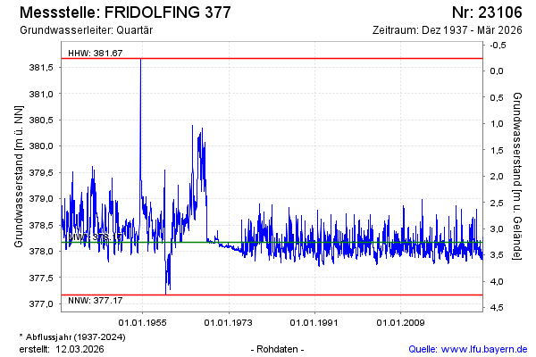
Chart of total period FRIDOLFING 377
Groundwater level [m above sealevel]: 377,88
Distance to surface [m]: 3,55
Last value from 08.07.2026 07:00
Ground level [m above sealevel]: 381.43
| Date | Groundwater level [m above sealevel] |
|---|---|
| 08.07.2026 | 377.87 |
| 07.07.2026 | 377.86 |
| 06.07.2026 | 377.86 |
| 05.07.2026 | 377.84 |
| 04.07.2026 | 377.84 |
| 03.07.2026 | 377.83 |
| 02.07.2026 | 377.83 |
| 01.07.2026 | 377.82 |