
- Start >
- Groundwater >
- Waterlevel of upper layer >
- Inn >
- FORSTINNING 511 >
- Year chart of precipitation

Year chart of precipitation FORSTINNING 511
Groundwater levels of the last 12 months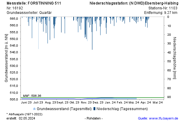
note
Die Messstelle wird wöchentlich beobachtet.
Groundwater level [m above sealevel]: 505,48
Distance to surface [m]: 6,51
Last value from 22.02.2026 10:00
Ground level [m above sealevel]: 511.99
© Bayerisches Landesamt für Umwelt 2026