
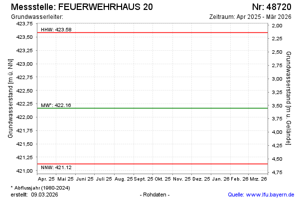
Current data FEUERWEHRHAUS 20
note
Die Messstelle wird nicht mehr beobachtet.
Groundwater level [m above sealevel]: 421.66
Distance to surface [m]: 4.06
Last value from 10.04.2026 07:05
Ground level [m above sealevel]: 425.72
| Date | Groundwater level [m above sealevel] |
|---|---|
| 16.10.2025 | 421.94 |
| 24.04.2025 | 421.75 |
| 10.10.2024 | 422.98 |
| 18.04.2024 | 422.41 |
| 19.10.2023 | 421.98 |
| 20.04.2023 | 421.87 |
| 20.10.2022 | 421.98 |
| 13.04.2022 | 421.77 |