Year chart of precipitation FERNM.A.AICHERSTR.5 18
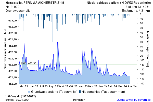
Groundwater level [m above sealevel]: 452,14
Distance to surface [m]: 2,70
Last value from 15.07.2026 09:58
Ground level [m above sealevel]: 454.84

Groundwater level [m above sealevel]: 452,14
Distance to surface [m]: 2,70
Last value from 15.07.2026 09:58
Ground level [m above sealevel]: 454.84