
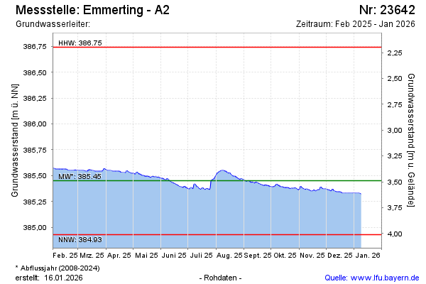
Current data Emmerting - A2
Groundwater level [m above sealevel]: 385.25
Distance to surface [m]: 3.69
Last value from 24.06.2026 09:00
Ground level [m above sealevel]: 388.94
| Date | Groundwater level [m above sealevel] |
|---|---|
| 27.06.2026 | 385.24 |
| 26.06.2026 | 385.25 |
| 25.06.2026 | 385.25 |
| 24.06.2026 | 385.25 |
| 23.06.2026 | 385.26 |
| 22.06.2026 | 385.26 |
| 21.06.2026 | 385.26 |
| 20.06.2026 | 385.27 |