
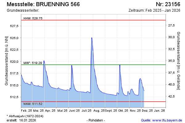
Current data BRUENNING 566
Groundwater level [m above sealevel]: 512.07
Distance to surface [m]: 43.1
Last value from 06.05.2026 07:04
Ground level [m above sealevel]: 555.17
| Date | Groundwater level [m above sealevel] |
|---|---|
| 06.05.2026 | 512.07 |
| 05.05.2026 | 512.08 |
| 04.05.2026 | 512.08 |
| 03.05.2026 | 512.08 |
| 02.05.2026 | 512.07 |
| 01.05.2026 | 512.07 |
| 30.04.2026 | 512.07 |
| 29.04.2026 | 512.08 |