
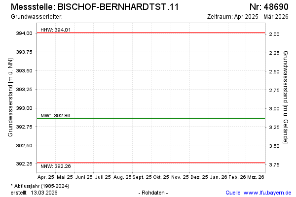
Current data BISCHOF-BERNHARDTST.11
note
Die Messstelle wird nicht mehr beobachtet
Groundwater level [m above sealevel]: 392.69
Distance to surface [m]: 3.3
Last value from 10.04.2026 06:38
Ground level [m above sealevel]: 395.99
| Date | Groundwater level [m above sealevel] |
|---|---|
| 15.10.2025 | 392.61 |
| 24.04.2025 | 392.91 |
| 10.10.2024 | 393.64 |
| 16.04.2024 | 393.06 |
| 19.10.2023 | 392.77 |
| 19.04.2023 | 392.79 |
| 18.10.2022 | 392.67 |
| 13.04.2022 | 392.95 |