
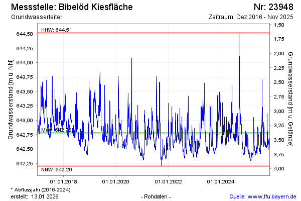
Chart of total period Bibelöd Kiesfläche
Groundwater level [m above sealevel]: 642.52
Distance to surface [m]: 3.64
Last value from 20.03.2026 09:47
Ground level [m above sealevel]: 646.16
| Date | Groundwater level [m above sealevel] |
|---|---|
| 20.03.2026 | 642.52 |
| 19.03.2026 | 642.53 |
| 18.03.2026 | 642.55 |
| 17.03.2026 | 642.56 |
| 16.03.2026 | 642.54 |
| 15.03.2026 | 642.56 |
| 14.03.2026 | 642.59 |
| 13.03.2026 | 642.61 |