
- Start >
- Groundwater >
- Waterlevel of upper layer >
- Inn >
- BAHNTUNNEL 16A >
- Chart of total period

Chart of total period BAHNTUNNEL 16A
Groundwater levels of the total period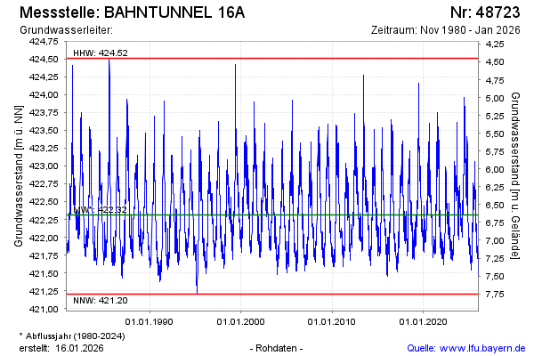
Groundwater level [m above sealevel]: 421.95
Distance to surface [m]: 7.01
Last value from 07.05.2026 08:10
Ground level [m above sealevel]: 428.96
| Date | Groundwater level [m above sealevel] |
|---|---|
| 07.05.2026 | 421.97 |
| 06.05.2026 | 422.01 |
| 05.05.2026 | 421.99 |
| 04.05.2026 | 421.93 |
| 03.05.2026 | 421.92 |
| 02.05.2026 | 421.89 |
| 01.05.2026 | 421.89 |
| 30.04.2026 | 421.91 |
© Bayerisches Landesamt für Umwelt 2026