
Chart of total period B02-Wassermauth
Groundwater level [m above sealevel]: 402.46
Distance to surface [m]: 7.59
Last value from 13.01.2026 17:00
Ground level [m above sealevel]: 410.05
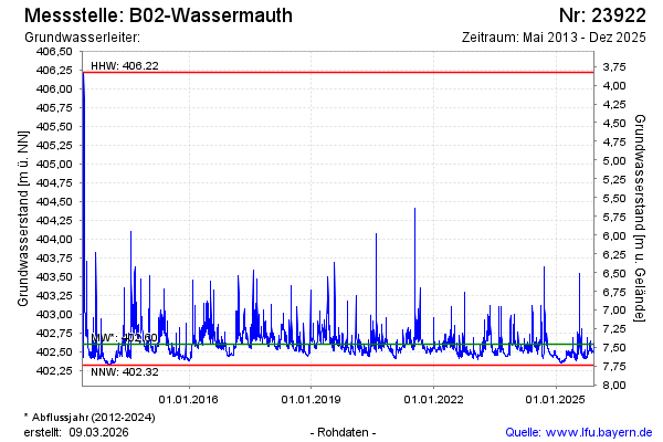
| Date | Groundwater level [m above sealevel] |
|---|---|
| 13.01.2026 | 402.44 |
| 12.01.2026 | 402.42 |
| 11.01.2026 | 402.42 |
| 10.01.2026 | 402.43 |
| 09.01.2026 | 402.43 |
| 08.01.2026 | 402.43 |
| 07.01.2026 | 402.43 |
| 06.01.2026 | 402.44 |