
Chart of total period B01-Bruch
Groundwater level [m above sealevel]: 416.29
Distance to surface [m]: 4.46
Last value from 14.07.2025 08:00
Ground level [m above sealevel]: 420.75
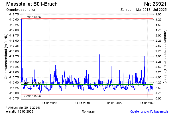
| Date | Groundwater level [m above sealevel] |
|---|---|
| 14.07.2025 | 416.29 |
| 13.07.2025 | 416.31 |
| 12.07.2025 | 416.35 |
| 11.07.2025 | 416.39 |
| 10.07.2025 | 416.45 |
| 09.07.2025 | 416.48 |
| 08.07.2025 | 416.33 |
| 07.07.2025 | 416.15 |