
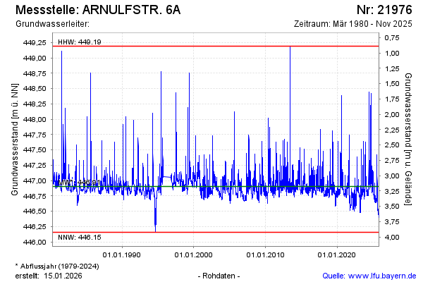
Chart of total period ARNULFSTR. 6A
note
Die Messstelle musste 1996 verlegt werden !
Groundwater level [m above sealevel]: 446.70
Distance to surface [m]: 3.38
Last value from 05.05.2026 14:13
Ground level [m above sealevel]: 450.08
| Date | Groundwater level [m above sealevel] |
|---|---|
| 05.05.2026 | 446.69 |
| 04.05.2026 | 446.69 |
| 03.05.2026 | 446.69 |
| 02.05.2026 | 446.69 |
| 01.05.2026 | 446.69 |
| 30.04.2026 | 446.69 |
| 29.04.2026 | 446.70 |
| 28.04.2026 | 446.70 |