
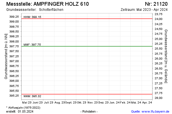
Current data AMPFINGER HOLZ 610
note
Die Messstelle wird nicht mehr beobachtet.
Groundwater level [m above sealevel]: 396.48
Distance to surface [m]: 26.65
Last value from 16.04.2026 11:56
Ground level [m above sealevel]: 423.13
| Date | Groundwater level [m above sealevel] |
|---|---|
| 16.10.2025 | 397.06 |
| 22.04.2025 | 397.64 |
| 10.10.2024 | 397.54 |
| 18.04.2024 | 397.10 |
| 19.10.2023 | 396.21 |
| 19.04.2023 | 396.07 |
| 18.10.2022 | 395.87 |
| 12.04.2022 | 395.77 |