
Current data AM WALDRAND 1 KO 46
Groundwater level [m above sealevel]: 460.50
Distance to surface [m]: 2.74
Last value from 06.05.2026 10:35
Ground level [m above sealevel]: 463.24
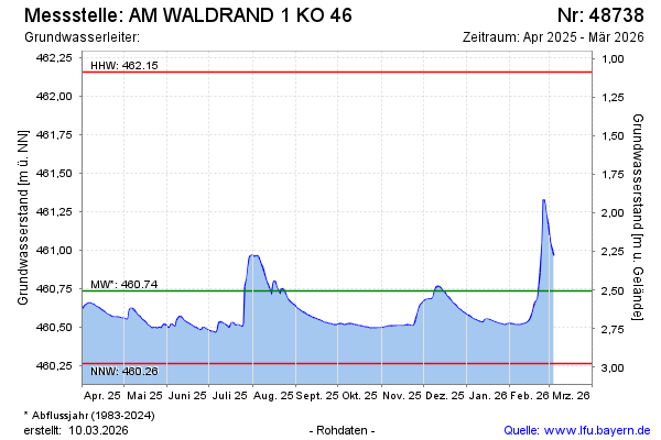
| Date | Groundwater level [m above sealevel] |
|---|---|
| 06.05.2026 | 460.49 |
| 05.05.2026 | 460.49 |
| 04.05.2026 | 460.50 |
| 03.05.2026 | 460.50 |
| 02.05.2026 | 460.50 |
| 01.05.2026 | 460.51 |
| 30.04.2026 | 460.51 |
| 29.04.2026 | 460.51 |