
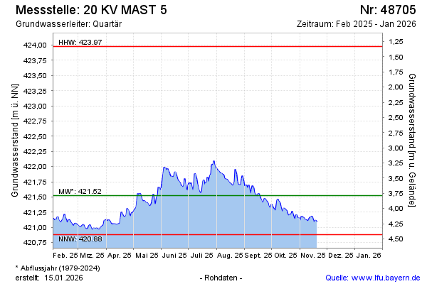
Current data 20 KV MAST 5
Groundwater level [m above sealevel]: 421.76
Distance to surface [m]: 3.55
Last value from 17.06.2026 07:28
Ground level [m above sealevel]: 425.31
| Date | Groundwater level [m above sealevel] |
|---|---|
| 17.06.2026 | 421.74 |
| 16.06.2026 | 421.72 |
| 15.06.2026 | 421.73 |
| 14.06.2026 | 421.77 |
| 13.06.2026 | 421.84 |
| 12.06.2026 | 421.85 |
| 11.06.2026 | 421.92 |
| 10.06.2026 | 421.80 |