
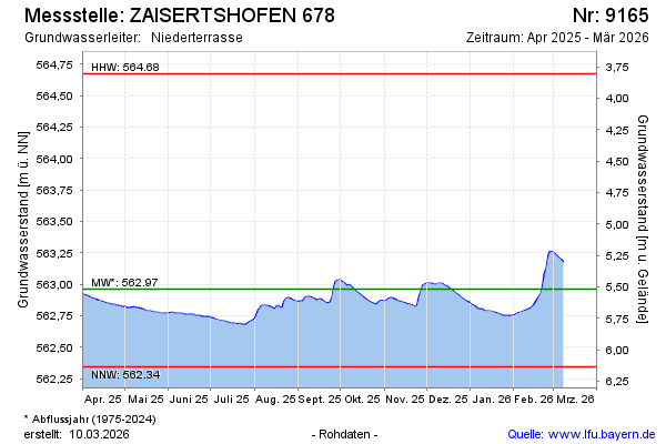
Current data ZAISERTSHOFEN 678
Groundwater level [m above sealevel]: 562.56
Distance to surface [m]: 5.9200000000001
Last value from 14.07.2026 09:00
Ground level [m above sealevel]: 568.48
| Date | Groundwater level [m above sealevel] |
|---|---|
| 14.07.2026 | 562.57 |
| 13.07.2026 | 562.57 |
| 12.07.2026 | 562.57 |
| 11.07.2026 | 562.57 |
| 10.07.2026 | 562.58 |
| 09.07.2026 | 562.58 |
| 08.07.2026 | 562.59 |
| 07.07.2026 | 562.59 |