
- Start >
- Groundwater >
- Waterlevel of upper layer >
- Iller - Lech - Bodensee >
- Wullenstetten, Kässbohrer Nord (BGW 2) >
- Current data

Current data Wullenstetten, Kässbohrer Nord (BGW 2)
Groundwater levels of the last 12 months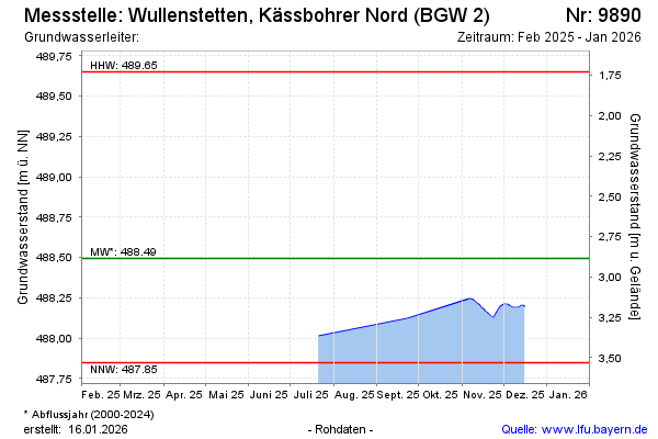
Groundwater level [m above sealevel]: 488.19
Distance to surface [m]: 3.19
Last value from 16.12.2025 13:26
Ground level [m above sealevel]: 491.38
| Date | Groundwater level [m above sealevel] |
|---|---|
| 16.12.2025 | 488.19 |
| 15.12.2025 | 488.20 |
| 14.12.2025 | 488.20 |
| 13.12.2025 | 488.20 |
| 12.12.2025 | 488.19 |
| 11.12.2025 | 488.19 |
| 10.12.2025 | 488.19 |
| 09.12.2025 | 488.19 |
© Bayerisches Landesamt für Umwelt 2026