
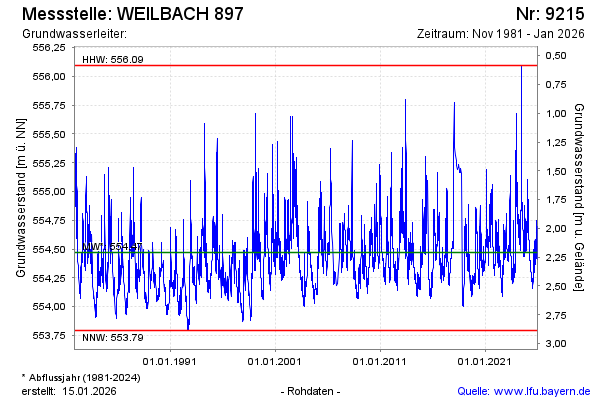
Chart of total period WEILBACH 897
Groundwater level [m above sealevel]: 554,13
Distance to surface [m]: 2,55
Last value from 02.07.2026 13:45
Ground level [m above sealevel]: 556.68
| Date | Groundwater level [m above sealevel] |
|---|---|
| 02.07.2026 | 554.05 |
| 01.07.2026 | 554.04 |
| 30.06.2026 | 554.04 |
| 29.06.2026 | 554.04 |
| 28.06.2026 | 554.05 |
| 27.06.2026 | 554.06 |
| 26.06.2026 | 554.07 |
| 25.06.2026 | 554.07 |