
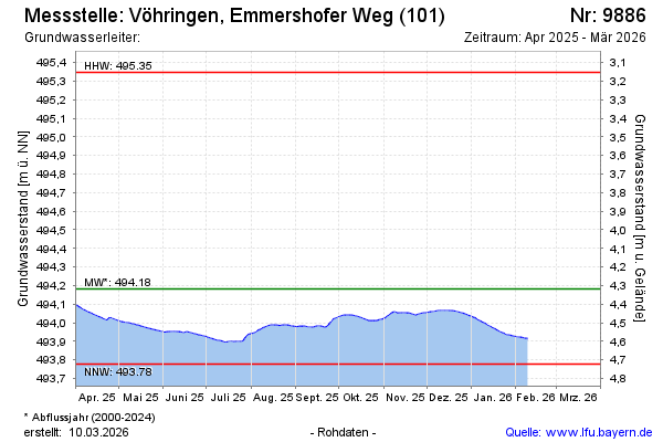
Current data Vöhringen, Emmershofer Weg (101)
Groundwater level [m above sealevel]: 493,93
Distance to surface [m]: 4,57
Last value from 15.06.2026 08:46
Ground level [m above sealevel]: 498.50
| Date | Groundwater level [m above sealevel] |
|---|---|
| 15.06.2026 | 493.93 |
| 14.06.2026 | 493.93 |
| 13.06.2026 | 493.93 |
| 12.06.2026 | 493.93 |
| 11.06.2026 | 493.94 |
| 10.06.2026 | 493.94 |
| 09.06.2026 | 493.94 |
| 08.06.2026 | 493.94 |