
- Start >
- Groundwater >
- Waterlevel of upper layer >
- Iller - Lech - Bodensee >
- THIERHAUPTEN 737 >
- Chart of total period

Chart of total period THIERHAUPTEN 737
Groundwater levels of the total period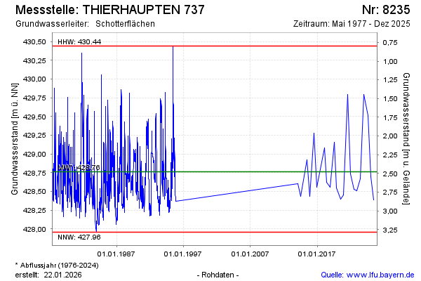
Groundwater level [m above sealevel]: 428.55
Distance to surface [m]: 2.69
Last value from 16.12.2025 10:00
Ground level [m above sealevel]: 431.24
| Date | Groundwater level [m above sealevel] |
|---|---|
| 04.06.2025 | 428.39 |
| 03.06.2025 | 428.39 |
| 05.12.2024 | 428.70 |
| 05.07.2024 | 429.51 |
| 15.12.2023 | 429.80 |
| 14.06.2023 | 428.67 |
| 30.11.2022 | 428.51 |
| 20.06.2022 | 428.53 |
© Bayerisches Landesamt für Umwelt 2026