
Current data Siefenwang_HRB_BK4
Groundwater level [m above sealevel]: 460.74
Distance to surface [m]: 1.24
Last value from 08.06.2026 10:16
Ground level [m above sealevel]: 461.98
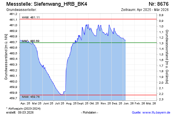
| Date | Groundwater level [m above sealevel] |
|---|---|
| 08.06.2026 | 460.74 |
| 07.06.2026 | 460.73 |
| 06.06.2026 | 460.75 |
| 05.06.2026 | 460.77 |
| 04.06.2026 | 460.75 |
| 03.06.2026 | 460.73 |
| 02.06.2026 | 460.71 |
| 01.06.2026 | 460.70 |