
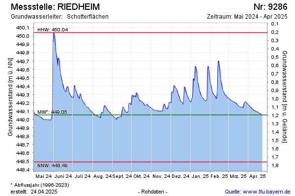
Current data RIEDHEIM
Groundwater level [m above sealevel]: 448.69
Distance to surface [m]: 1.56
Last value from 24.06.2026 11:00
Ground level [m above sealevel]: 450.25
| Date | Groundwater level [m above sealevel] |
|---|---|
| 26.06.2026 | 448.67 |
| 25.06.2026 | 448.68 |
| 24.06.2026 | 448.68 |
| 23.06.2026 | 448.69 |
| 22.06.2026 | 448.69 |
| 21.06.2026 | 448.70 |
| 20.06.2026 | 448.71 |
| 19.06.2026 | 448.73 |