
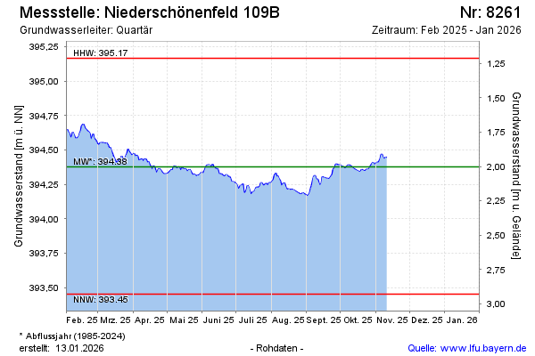
Current data Niederschönenfeld 109B
Groundwater level [m above sealevel]: 394,14
Distance to surface [m]: 2,24
Last value from 22.07.2026 09:00
Ground level [m above sealevel]: 396.38
| Date | Groundwater level [m above sealevel] |
|---|---|
| 22.07.2026 | 394.14 |
| 21.07.2026 | 394.14 |
| 20.07.2026 | 394.15 |
| 19.07.2026 | 394.17 |
| 18.07.2026 | 394.19 |
| 17.07.2026 | 394.20 |
| 16.07.2026 | 394.19 |
| 15.07.2026 | 394.20 |