
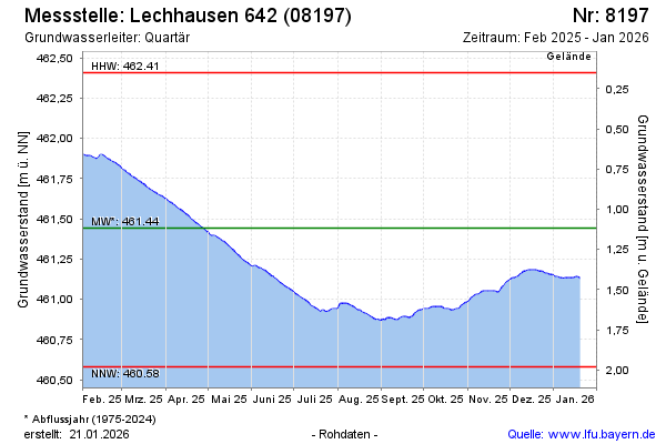
Current data LECHHAUSEN 642
Groundwater level [m above sealevel]: 460.85
Distance to surface [m]: 1.71
Last value from 12.07.2026 08:00
Ground level [m above sealevel]: 462.56
| Date | Groundwater level [m above sealevel] |
|---|---|
| 12.07.2026 | 460.85 |
| 11.07.2026 | 460.86 |
| 10.07.2026 | 460.86 |
| 09.07.2026 | 460.86 |
| 08.07.2026 | 460.87 |
| 07.07.2026 | 460.87 |
| 06.07.2026 | 460.88 |
| 05.07.2026 | 460.88 |