
- Start >
- Groundwater >
- Waterlevel of upper layer >
- Iller - Lech - Bodensee >
- Lechhausen 640 A >
- Chart of total period

Chart of total period Lechhausen 640 A
Groundwater levels of the total period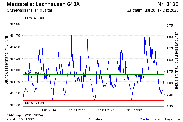
Groundwater level [m above sealevel]: 464.05
Distance to surface [m]: 1.67
Last value from 26.03.2026 12:49
Ground level [m above sealevel]: 465.72
| Date | Groundwater level [m above sealevel] |
|---|---|
| 26.03.2026 | 464.06 |
| 25.03.2026 | 464.07 |
| 24.03.2026 | 464.07 |
| 23.03.2026 | 464.07 |
| 22.03.2026 | 464.08 |
| 21.03.2026 | 464.09 |
| 20.03.2026 | 464.10 |
| 19.03.2026 | 464.10 |
© Bayerisches Landesamt für Umwelt 2026