
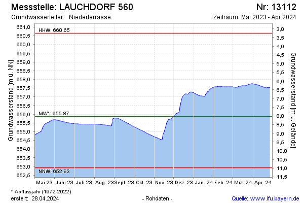
Current data LAUCHDORF 560
Groundwater level [m above sealevel]: 654.19
Distance to surface [m]: 9.7099999999999
Last value from 14.07.2026 04:00
Ground level [m above sealevel]: 663.90
| Date | Groundwater level [m above sealevel] |
|---|---|
| 13.07.2026 | 654.20 |
| 12.07.2026 | 654.21 |
| 11.07.2026 | 654.22 |
| 10.07.2026 | 654.24 |
| 09.07.2026 | 654.25 |
| 08.07.2026 | 654.26 |
| 07.07.2026 | 654.27 |
| 06.07.2026 | 654.28 |