
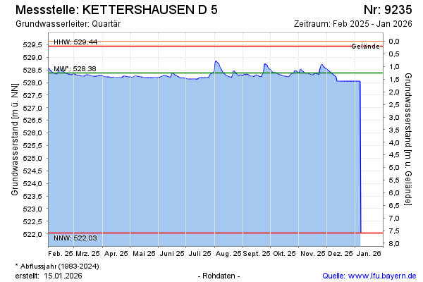
Current data KETTERSHAUSEN D 5
Groundwater level [m above sealevel]: 528.09
Distance to surface [m]: 1.54
Last value from 02.07.2026 10:42
Ground level [m above sealevel]: 529.63
| Date | Groundwater level [m above sealevel] |
|---|---|
| 02.06.2026 | 528.14 |
| 01.06.2026 | 528.13 |
| 31.05.2026 | 528.11 |
| 30.05.2026 | 528.10 |
| 29.05.2026 | 528.11 |
| 28.05.2026 | 528.12 |
| 27.05.2026 | 528.13 |
| 26.05.2026 | 528.13 |