
- Start >
- Groundwater >
- Waterlevel of upper layer >
- Iller - Lech - Bodensee >
- HWF-DONAUWOERTH P4 >
- Chart of total period

Chart of total period HWF-DONAUWOERTH P4
Groundwater levels of the total period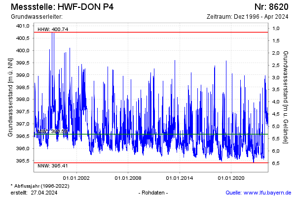
Groundwater level [m above sealevel]: 396.01
Distance to surface [m]: 5.89
Last value from 18.12.2025 10:22
Ground level [m above sealevel]: 401.90
| Date | Groundwater level [m above sealevel] |
|---|---|
| 18.12.2025 | 396.02 |
| 17.12.2025 | 396.05 |
| 16.12.2025 | 396.08 |
| 15.12.2025 | 396.14 |
| 14.12.2025 | 396.20 |
| 13.12.2025 | 396.27 |
| 12.12.2025 | 396.39 |
| 11.12.2025 | 396.51 |
© Bayerisches Landesamt für Umwelt 2026