
- Start >
- Groundwater >
- Waterlevel of upper layer >
- Iller - Lech - Bodensee >
- GUNDELFINGEN D 50 >
- Chart of total period

Chart of total period GUNDELFINGEN D 50
Groundwater levels of the total period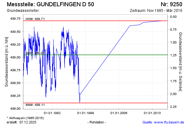
Groundwater level [m above sealevel]: 439.65
Distance to surface [m]: 0.64
Last value from 15.03.2016 13:03
Ground level [m above sealevel]: 440.29
| Date | Groundwater level [m above sealevel] |
|---|---|
| 29.01.2015 | 439.71 |
| 09.03.2011 | 439.68 |
| 31.03.2010 | 439.63 |
| 09.04.2008 | 439.61 |
| 31.10.1997 | 438.27 |
| 24.10.1997 | 438.29 |
| 20.10.1997 | 438.29 |
| 15.10.1997 | 438.28 |
© Bayerisches Landesamt für Umwelt 2024