
- Start >
- Groundwater >
- Waterlevel of upper layer >
- Iller - Lech - Bodensee >
- Gersthofen_LEW_TB_1 >
- Current data

Current data Gersthofen_LEW_TB_1
Groundwater levels of the last 12 months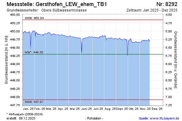
Groundwater level [m above sealevel]: 449.67
Distance to surface [m]: 5.33
Last value from 23.04.2026 11:20
Ground level [m above sealevel]: 455.00
| Date | Groundwater level [m above sealevel] |
|---|---|
| 23.04.2026 | 449.68 |
| 22.04.2026 | 449.68 |
| 21.04.2026 | 449.69 |
| 20.04.2026 | 449.70 |
| 19.04.2026 | 449.71 |
| 18.04.2026 | 449.70 |
| 17.04.2026 | 449.70 |
| 16.04.2026 | 449.69 |
© Bayerisches Landesamt für Umwelt 2026