
- Start >
- Groundwater >
- Waterlevel of upper layer >
- Iller - Lech - Bodensee >
- GERSTHOFEN 97 >
- Chart of total period

Chart of total period GERSTHOFEN 97
Groundwater levels of the total period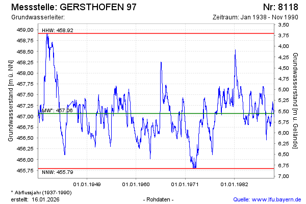
Groundwater level [m above sealevel]: 456.95
Distance to surface [m]: 5.67
Last value from 25.11.1990 12:00
Ground level [m above sealevel]: 462.62
| Date | Groundwater level [m above sealevel] |
|---|---|
| 18.11.1990 | 456.98 |
| 11.11.1990 | 457.00 |
| 04.11.1990 | 457.03 |
| 29.10.1990 | 457.02 |
| 22.10.1990 | 457.04 |
| 15.10.1990 | 457.06 |
| 08.10.1990 | 457.09 |
| 01.10.1990 | 457.11 |
© Bayerisches Landesamt für Umwelt 2026