
- Start >
- Groundwater >
- Waterlevel of upper layer >
- Iller - Lech - Bodensee >
- Gerlenhofen, nördlich an Biotopfläche >
- Chart of total period

Chart of total period Gerlenhofen, nördlich an Biotopfläche
Groundwater levels of the total period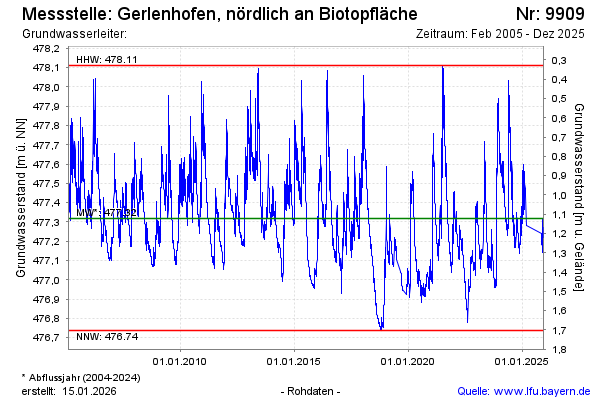
Groundwater level [m above sealevel]: 477.28
Distance to surface [m]: 1.16
Last value from 06.03.2025 13:32
Ground level [m above sealevel]: 478.44
| Date | Groundwater level [m above sealevel] |
|---|---|
| 19.02.2025 | 477.44 |
| 18.02.2025 | 477.45 |
| 17.02.2025 | 477.48 |
| 16.02.2025 | 477.50 |
| 15.02.2025 | 477.52 |
| 14.02.2025 | 477.56 |
| 13.02.2025 | 477.53 |
| 12.02.2025 | 477.43 |
© Bayerisches Landesamt für Umwelt 2026