
- Start >
- Groundwater >
- Waterlevel of upper layer >
- Iller - Lech - Bodensee >
- Gablonzerweg, Unterflur >
- Chart of total period

Chart of total period Gablonzerweg, Unterflur
Groundwater levels of the total period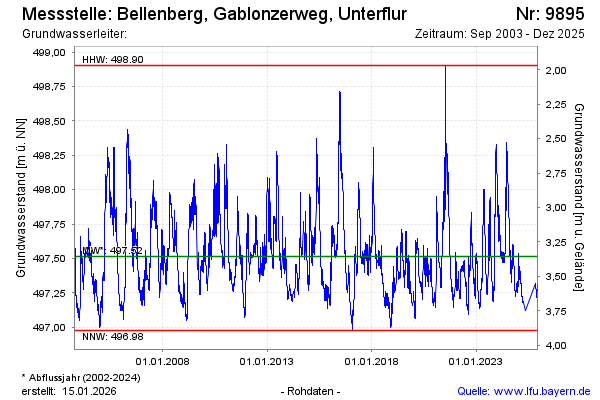
Groundwater level [m above sealevel]: 497.46
Distance to surface [m]: 3.41
Last value from 17.03.2026 13:24
Ground level [m above sealevel]: 500.87
| Date | Groundwater level [m above sealevel] |
|---|---|
| 17.03.2026 | 497.46 |
| 16.03.2026 | 497.47 |
| 15.03.2026 | 497.49 |
| 14.03.2026 | 497.50 |
| 13.03.2026 | 497.51 |
| 12.03.2026 | 497.52 |
| 11.03.2026 | 497.53 |
| 10.03.2026 | 497.54 |
© Bayerisches Landesamt für Umwelt 2026