
- Start >
- Groundwater >
- Waterlevel of upper layer >
- Iller - Lech - Bodensee >
- EPPISBURG 459A >
- Current data

Current data EPPISBURG 459A
Groundwater levels of the last 12 months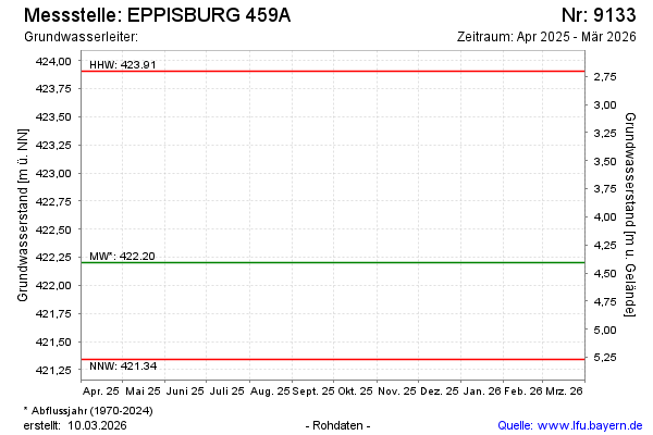
Groundwater level [m above sealevel]: 422.41
Distance to surface [m]: 4.20
Last value from 11.04.2024 09:10
Ground level [m above sealevel]: 426.61
| Date | Groundwater level [m above sealevel] |
|---|---|
| 04.09.2023 | 422.01 |
| 23.02.2023 | 421.95 |
| 02.09.2022 | 421.45 |
| 17.02.2022 | 422.29 |
| 07.09.2021 | 422.44 |
| 04.03.2021 | 422.24 |
| 08.09.2020 | 421.61 |
| 12.03.2020 | 422.04 |
© Bayerisches Landesamt für Umwelt 2024