
- Start >
- Groundwater >
- Waterlevel of upper layer >
- Iller - Lech - Bodensee >
- DERCHING 638 A >
- Chart of total period

Chart of total period DERCHING 638 A
Groundwater levels of the total period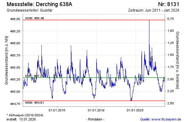
Groundwater level [m above sealevel]: 465.36
Distance to surface [m]: 1.90
Last value from 18.05.2024 09:00
Ground level [m above sealevel]: 467.26
| Date | Groundwater level [m above sealevel] |
|---|---|
| 18.05.2024 | 465.36 |
| 17.05.2024 | 465.35 |
| 16.05.2024 | 465.34 |
| 15.05.2024 | 465.35 |
| 14.05.2024 | 465.36 |
| 13.05.2024 | 465.35 |
| 12.05.2024 | 465.34 |
| 11.05.2024 | 465.35 |
© Bayerisches Landesamt für Umwelt 2024