
- Start >
- Groundwater >
- Waterlevel of upper layer >
- Iller - Lech - Bodensee >
- Burgau HWS 8A/08 >
- Chart of total period

Chart of total period Burgau HWS 8A/08
Groundwater levels of the total period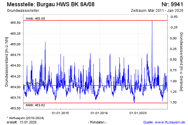
Groundwater level [m above sealevel]: 453.98
Distance to surface [m]: 1.16
Last value from 12.03.2026 14:13
Ground level [m above sealevel]: 455.14
| Date | Groundwater level [m above sealevel] |
|---|---|
| 12.03.2026 | 453.97 |
| 11.03.2026 | 453.98 |
| 10.03.2026 | 453.98 |
| 09.03.2026 | 453.99 |
| 08.03.2026 | 454.01 |
| 07.03.2026 | 454.02 |
| 06.03.2026 | 454.04 |
| 05.03.2026 | 454.05 |
© Bayerisches Landesamt für Umwelt 2026