
- Start >
- Groundwater >
- Waterlevel of upper layer >
- Iller - Lech - Bodensee >
- BATZENHOFEN 17 >
- Chart of total period

Chart of total period BATZENHOFEN 17
Groundwater levels of the total period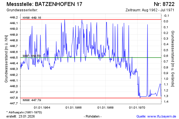
Groundwater level [m above sealevel]: 447.82
Distance to surface [m]: 1.31
Last value from 10.07.1971 12:00
Ground level [m above sealevel]: 449.13
| Date | Groundwater level [m above sealevel] |
|---|---|
| 03.07.1971 | 447.82 |
| 19.06.1971 | 448.04 |
| 12.06.1971 | 448.04 |
| 27.03.1971 | 447.83 |
| 20.03.1971 | 447.84 |
| 27.02.1971 | 447.88 |
| 20.02.1971 | 447.87 |
| 30.01.1971 | 447.86 |
© Bayerisches Landesamt für Umwelt 2026