
- Start >
- Groundwater >
- Waterlevel of upper layer >
- Iller - Lech - Bodensee >
- Ay, Unterm Schloß >
- Chart of total period

Chart of total period Ay, Unterm Schloß
Groundwater levels of the total period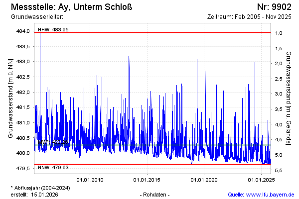
Groundwater level [m above sealevel]: 480.13
Distance to surface [m]: 4.81
Last value from 09.04.2024 08:38
Ground level [m above sealevel]: 484.94
| Date | Groundwater level [m above sealevel] |
|---|---|
| 09.04.2024 | 480.10 |
| 08.04.2024 | 480.03 |
| 07.04.2024 | 480.00 |
| 06.04.2024 | 479.93 |
| 05.04.2024 | 479.92 |
| 04.04.2024 | 479.94 |
| 03.04.2024 | 480.01 |
| 02.04.2024 | 480.06 |
© Bayerisches Landesamt für Umwelt 2024