
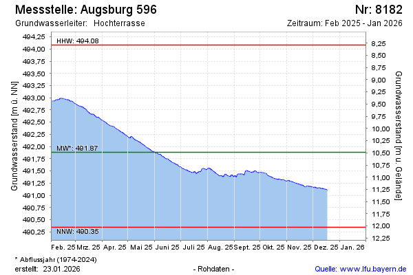
Current data Augsburg 596
Groundwater level [m above sealevel]: 491.38
Distance to surface [m]: 10.99
Last value from 26.05.2026 07:18
Ground level [m above sealevel]: 502.37
| Date | Groundwater level [m above sealevel] |
|---|---|
| 26.05.2026 | 491.38 |
| 25.05.2026 | 491.38 |
| 24.05.2026 | 491.39 |
| 23.05.2026 | 491.40 |
| 22.05.2026 | 491.41 |
| 21.05.2026 | 491.41 |
| 20.05.2026 | 491.42 |
| 19.05.2026 | 491.43 |