
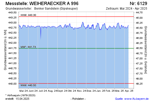
Current data WEIHERAECKER A 996
Groundwater level [m above sealevel]: 442.66
Distance to surface [m]: 45.58
Last value from 24.06.2026 10:00
Ground level [m above sealevel]: 488.24
| Date | Groundwater level [m above sealevel] |
|---|---|
| 28.06.2026 | 442.70 |
| 27.06.2026 | 442.69 |
| 26.06.2026 | 442.68 |
| 25.06.2026 | 442.68 |
| 24.06.2026 | 442.68 |
| 23.06.2026 | 442.66 |
| 22.06.2026 | 442.64 |
| 21.06.2026 | 442.65 |