
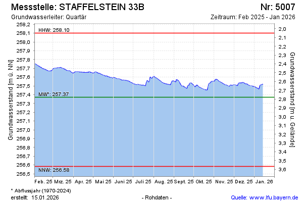
Current data STAFFELSTEIN 33B
Groundwater level [m above sealevel]: 257.52
Distance to surface [m]: 2.63
Last value from 24.06.2026 08:01
Ground level [m above sealevel]: 260.15
| Date | Groundwater level [m above sealevel] |
|---|---|
| 28.06.2026 | 257.50 |
| 27.06.2026 | 257.50 |
| 26.06.2026 | 257.50 |
| 25.06.2026 | 257.51 |
| 24.06.2026 | 257.52 |
| 23.06.2026 | 257.53 |
| 22.06.2026 | 257.53 |
| 21.06.2026 | 257.54 |