
- Start >
- Groundwater >
- Waterlevel of upper layer >
- Oberer Main - Elbe >
- STADTSTEINACH 9A >
- Chart of total period

Chart of total period STADTSTEINACH 9A
Groundwater levels of the total period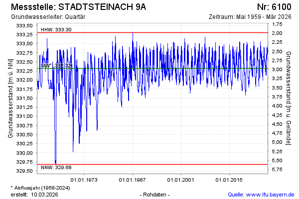
Groundwater level [m above sealevel]: 332.75
Distance to surface [m]: 2.54
Last value from 22.01.2026 09:00
Ground level [m above sealevel]: 335.29
| Date | Groundwater level [m above sealevel] |
|---|---|
| 22.01.2026 | 332.76 |
| 21.01.2026 | 332.78 |
| 20.01.2026 | 332.80 |
| 19.01.2026 | 332.82 |
| 18.01.2026 | 332.84 |
| 17.01.2026 | 332.85 |
| 16.01.2026 | 332.88 |
| 15.01.2026 | 332.91 |
© Bayerisches Landesamt für Umwelt 2026