
- Start >
- Groundwater >
- Waterlevel of upper layer >
- Oberer Main - Elbe >
- SAUGENDORF BT-W2 >
- Chart of total period

Chart of total period SAUGENDORF BT-W2
Groundwater levels of the total period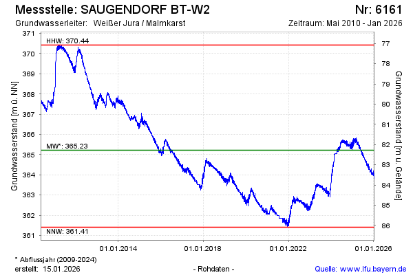
Groundwater level [m above sealevel]: 363.86
Distance to surface [m]: 83.64
Last value from 18.01.2026 10:00
Ground level [m above sealevel]: 447.50
| Date | Groundwater level [m above sealevel] |
|---|---|
| 18.01.2026 | 363.86 |
| 17.01.2026 | 363.87 |
| 16.01.2026 | 363.89 |
| 15.01.2026 | 363.91 |
| 14.01.2026 | 363.91 |
| 13.01.2026 | 363.93 |
| 12.01.2026 | 363.90 |
| 11.01.2026 | 363.81 |
© Bayerisches Landesamt für Umwelt 2026