
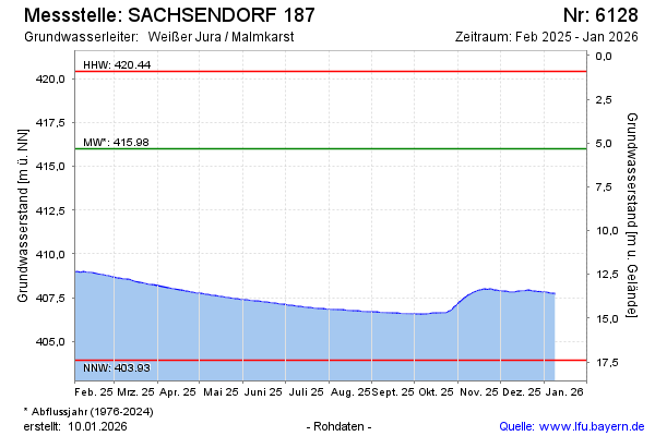
Current data SACHSENDORF 187
Groundwater level [m above sealevel]: 408.05
Distance to surface [m]: 13.28
Last value from 24.06.2026 10:00
Ground level [m above sealevel]: 421.33
| Date | Groundwater level [m above sealevel] |
|---|---|
| 30.06.2026 | 407.99 |
| 29.06.2026 | 408.00 |
| 28.06.2026 | 408.01 |
| 27.06.2026 | 408.02 |
| 26.06.2026 | 408.03 |
| 25.06.2026 | 408.04 |
| 24.06.2026 | 408.05 |
| 23.06.2026 | 408.06 |