
- Start >
- Groundwater >
- Waterlevel of upper layer >
- Oberer Main - Elbe >
- MELKENDORF 16B >
- Chart of total period

Chart of total period MELKENDORF 16B
Groundwater levels of the total period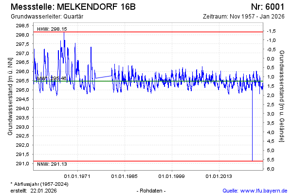
Groundwater level [m above sealevel]: 295.42
Distance to surface [m]: 1.29
Last value from 11.04.2026 09:00
Ground level [m above sealevel]: 296.71
| Date | Groundwater level [m above sealevel] |
|---|---|
| 11.04.2026 | 295.43 |
| 10.04.2026 | 295.44 |
| 09.04.2026 | 295.44 |
| 08.04.2026 | 295.43 |
| 07.04.2026 | 295.44 |
| 06.04.2026 | 295.43 |
| 05.04.2026 | 295.46 |
| 04.04.2026 | 295.46 |
© Bayerisches Landesamt für Umwelt 2026