
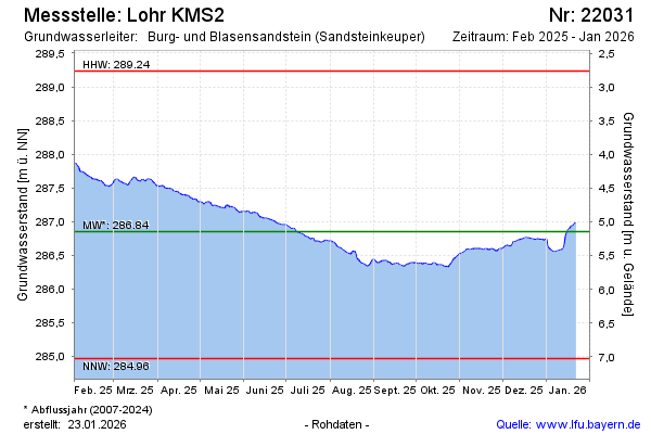
Current data Lohr KMS2
Groundwater level [m above sealevel]: 286.94
Distance to surface [m]: 5.05
Last value from 24.06.2026 10:00
Ground level [m above sealevel]: 291.99
| Date | Groundwater level [m above sealevel] |
|---|---|
| 28.06.2026 | 286.92 |
| 27.06.2026 | 286.92 |
| 26.06.2026 | 286.92 |
| 25.06.2026 | 286.93 |
| 24.06.2026 | 286.95 |
| 23.06.2026 | 286.97 |
| 22.06.2026 | 286.95 |
| 21.06.2026 | 286.93 |