
Chart of total period LEITENBACH (2)
Groundwater level [m above sealevel]: 235.29
Distance to surface [m]: 5.25
Last value from 14.07.2026 10:00
Ground level [m above sealevel]: 240.54
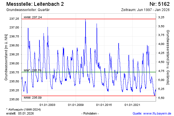
| Date | Groundwater level [m above sealevel] |
|---|---|
| 14.07.2026 | 235.31 |
| 13.07.2026 | 235.31 |
| 12.07.2026 | 235.31 |
| 11.07.2026 | 235.32 |
| 10.07.2026 | 235.33 |
| 09.07.2026 | 235.34 |
| 08.07.2026 | 235.34 |
| 07.07.2026 | 235.35 |