
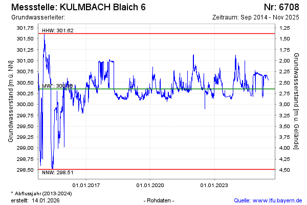
Chart of total period Kulmbach Blaich 6
Groundwater level [m above sealevel]: 300.13
Distance to surface [m]: 2.87
Last value from 01.07.2026 10:00
Ground level [m above sealevel]: 303.00
| Date | Groundwater level [m above sealevel] |
|---|---|
| 30.06.2026 | 300.07 |
| 29.06.2026 | 300.05 |
| 28.06.2026 | 300.05 |
| 27.06.2026 | 300.05 |
| 26.06.2026 | 300.06 |
| 25.06.2026 | 300.07 |
| 24.06.2026 | 300.08 |
| 23.06.2026 | 300.09 |